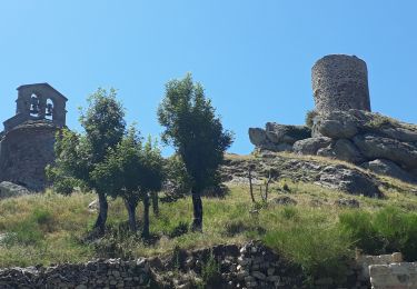
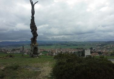
Trail  Le Vernet - La Durande - Photo
© OpenStreetMap contributors
Length
Length
13.7 km
Max alt
Max alt
1293 m
Uphill gradient
Uphill gradient
379 m
Km-Effort
Km-Effort  
18.7 km
Min alt
Min alt
1083 m
Downhill gradient
Downhill gradient
381 m
Boucle
Boucle
Yes
Creation date :
2023-09-13 18:16:41.488
Updated on :
2023-09-13 18:16:41.488

(0 Reviews)


Scan this QR Code to open this trail in the SityTrail application

FREE GPS app for hiking

Logo SityTrail SityTrail

IGN / Geographical institutes

Download SityTrail from the App Store Download SityTrail from Google Play

Logo SityTrail SityTrail World

The world is yours!

Download SityTrail from the App Store Download SityTrail from Google Play Download SityTrail on Huawei AppGallery

About

Trail of 13.7 km to be discovered at Auvergne-Rhône-Alpes, Haute-Loire, Le Vernet. This trail is proposed by guitounette.

Elevation profile

Points of interest

Point of interest Le Vernet - Parking - Photo
guitounette
LE VERNET 
Point of interest Le Vernet - Tables de pique-nique - Photo
guitounette
Point of interest Saint-Privat-d'Allier - Bifurcation - chemin à gauche - Photo
guitounette
SAINT-PRIVAT-D'ALLIER 
Point of interest Saint-Bérain - Aplomb ligne THT - à gauche - Photo
guitounette
Point of interest Saint-Bérain - D30 - Photo
guitounette
SAINT-BÉRAIN 
Point of interest Le Vernet - Bifurcation en T - à droite - Photo
guitounette
Point of interest Saint-Bérain - Croix - chemin du milieu  - Photo
guitounette
Point of interest Siaugues-Sainte-Marie - La Durande - Photo
guitounette
SIAUGUES-SAINTE-MARIE 
Point of interest Saint-Jean-de-Nay - Croisée de chemins - à gauche vers le sommet - Photo
guitounette
Point of interest Saint-Jean-de-Nay - Bifurcation - à gauche - Photo
guitounette
SAINT-JEAN-DE-NAY 
Point of interest Saint-Jean-de-Nay - Bifurcation - à droite - Photo
guitounette
SAINT-JEAN-DE-NAY 
Point of interest Saint-Jean-de-Nay - Croisement des 4 chemins - en face - Photo
guitounette
Point of interest Le Vernet - Croisement route - en face - Photo
guitounette
Point of interest Le Vernet - Bifurcation - à droite - Photo
guitounette
Point of interest Le Vernet - Parking - Photo
guitounette
LE VERNET 

Positioning

Country:
France
Region :
Auvergne-Rhône-Alpes
Department/Province :
Haute-Loire
Municipality :
Le Vernet
Location:
Unknown
Start:(UTM)
552716 ; 4987139 (31T) N.

Trails nearby

Trail Walking Saint-Privat-d'Allier - lac de l'oeuf / St Privat/ chapelle de Rochegude - Photo
Walking
GUIDE
nadinebondoux

Walking

Medium
Saint-Privat-d'Allier, Auvergne-Rhône-Alpes, Haute-Loire, France
19.1 km | 28 km-effort
6h 11min
Yes
Trail Walking Saint-Privat-d'Allier - saint Privat d'Allier - Saugues - Photo
Walking
RR31

Walking

Very difficult
Saint-Privat-d'Allier, Auvergne-Rhône-Alpes, Haute-Loire, France
24 km | 33 km-effort
10h 44min
No
Trail Walking Saint-Privat-d'Allier - St Privât a Saugue - Photo
Walking
Nono55

Walking

Difficult
Saint-Privat-d'Allier, Auvergne-Rhône-Alpes, Haute-Loire, France
22 km | 32 km-effort
5h 10min
No
Trail Walking Saint-Jean-de-Nay - Marée de limagne  - Photo
Walking
jph43000

Walking

Medium
Saint-Jean-de-Nay, Auvergne-Rhône-Alpes, Haute-Loire, France
13.1 km | 18.4 km-effort
2h 53min
Yes
Trail Horseback riding Saint-Privat-d'Allier - sixième journée randonnée de la vallée écrin vert 34kms - Photo
Horseback riding
jces

Horseback riding

Very difficult
Saint-Privat-d'Allier, Auvergne-Rhône-Alpes, Haute-Loire, France
34 km | 44 km-effort
5h 26min
No
Trail On foot Le Vernet - le Vernet et le sommet de la Durande - Photo
On foot
Jean-MarieFaux

On foot

Easy
Le Vernet, Auvergne-Rhône-Alpes, Haute-Loire, France
8.9 km | 12.4 km-effort
Unknown
No
Trail Mountain bike Saint-Jean-de-Nay - St Jean de Nay - Siaugues - Photo
Mountain bike
marcgiraud

Mountain bike

Medium
Saint-Jean-de-Nay, Auvergne-Rhône-Alpes, Haute-Loire, France
34 km | 48 km-effort
3h 42min
Yes
Trail Walking Le Vernet - Le Vernet pylone - Photo
Walking
danou56

Walking

Medium
Le Vernet, Auvergne-Rhône-Alpes, Haute-Loire, France
7.4 km | 10.1 km-effort
2h 8min
Yes
Trail Mountain bike Saint-Jean-de-Nay - St Jean de Nay - Siaugues - Le Thiolent - Photo
Mountain bike
marcgiraud

Mountain bike

Very easy
Saint-Jean-de-Nay, Auvergne-Rhône-Alpes, Haute-Loire, France
38 km | 53 km-effort
4h 0min
Yes


Close
My subscriptions